Trails
Coastal Trails
San Diego is rare among major American cities: you can hike a dramatic coastal cliff, a desert canyon, and a pine-forested mountain ridge, all within an hour's drive of downtown. The city's terrain rises from sea level to 6,500 feet across just 60 miles, and the variety of ecosystems — coastal sage scrub, chaparral, oak woodland, conifer forest, and Sonoran desert — makes it one of California's most biodiverse counties.
This guide focuses on the coastal and near-coastal trails that visitors and locals alike return to. Each trail entry below has been walked recently and includes notes on distance, difficulty, parking, best time of day, what to bring, and what makes it memorable. Distances are round-trip unless noted.
A few things to know before you set out: always confirm current closures before leaving. Cell service disappears in canyons and on the back side of bluffs. Water is rarely available — bring at least 1 liter per person for any walk over a mile. And the Pacific weather changes quickly: a sunny sunrise can become a foggy blanket by 9am, especially May through July.
Hiking Trails
Hit The Trails
Ten of San Diego's best coastal hikes — from Carlsbad lagoons to Point Loma bluffs, all within a few minutes of the Pacific.
 ModerateClosed
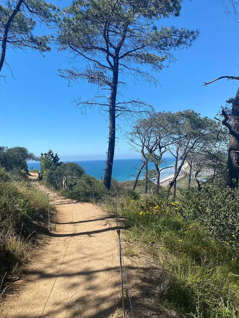
Torrey Pines Reserve Trails
Torrey Pines State Reserve, La Jolla
The reserve and every trail are closed through February 2027. Full access is expected March 1, 2027; the state beach remains open.
 Easy
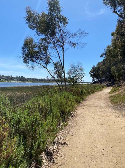
EasyBatiquitos Lagoon Trail
Carlsbad
Protected coastal lagoon teeming with herons, egrets, and migratory shorebirds — pure flat, pure calm.
 Easy
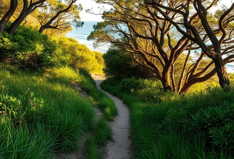
EasyCottonwood Creek to Moonlight Beach
Encinitas
Short, lush coastal corridor that opens onto Encinitas's beloved Moonlight Beach — perfect with kids.
 Easy
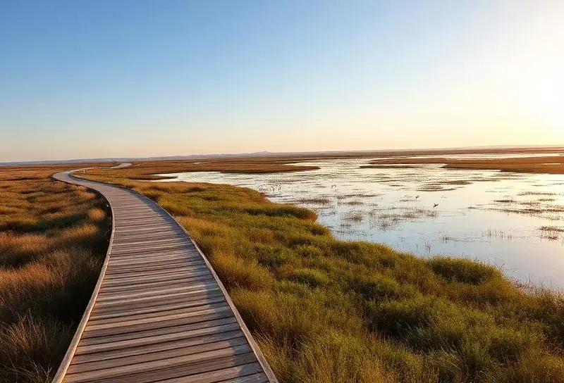
EasySan Elijo Lagoon Nature Center Loop
Solana Beach
Boardwalks and dirt paths around a coastal wetland — exceptional birding with lagoon and ocean views.
 Easy
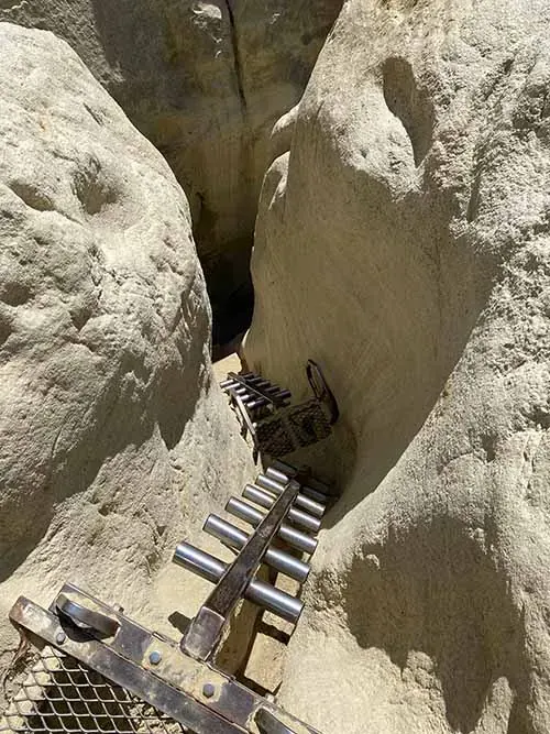
EasyAnnie's Canyon
San Elijo Lagoon, Solana Beach
Squeeze through a narrow sandstone slot canyon — one of San Diego's most unique coastal hikes.
 EasyClosed
Torrey Pines Razor Point & Beach Trail Loop
Torrey Pines State Reserve
The reserve and every trail are closed through February 2027. Full access is expected March 1, 2027; the state beach remains open.
EasyClosedTorrey Pines Guy Fleming Trail
Torrey Pines State Reserve
The reserve and every trail are closed through February 2027. Full access is expected March 1, 2027; the state beach remains open.
 Easy
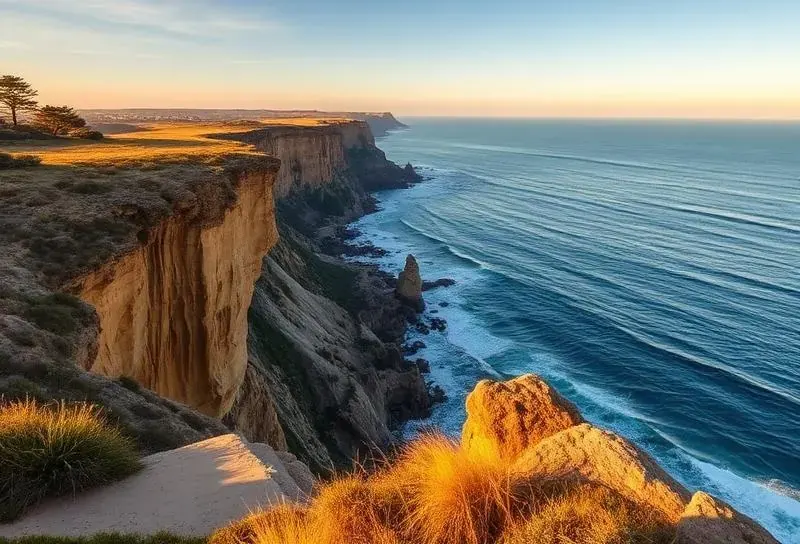
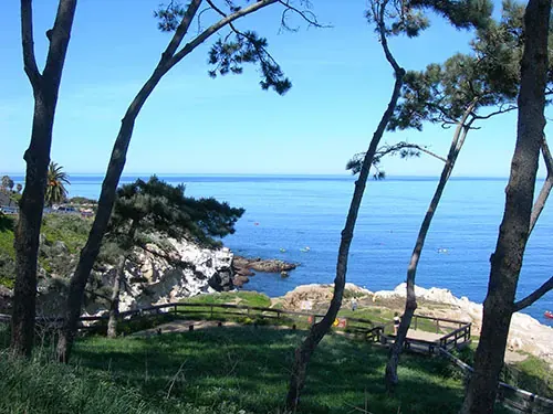
EasyCoast Walk Trail
La Jolla
Short bluff path above La Jolla's famous sea caves — turquoise water, twisted pines, sunset magic.
 Easy
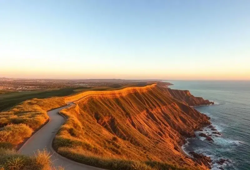
EasySunset Cliffs Coastal Trail
Point Loma
Walk dramatic clifftops above the Pacific — best hiked an hour before sunset.
 Easy
EasyBayside Trail
Cabrillo National Monument
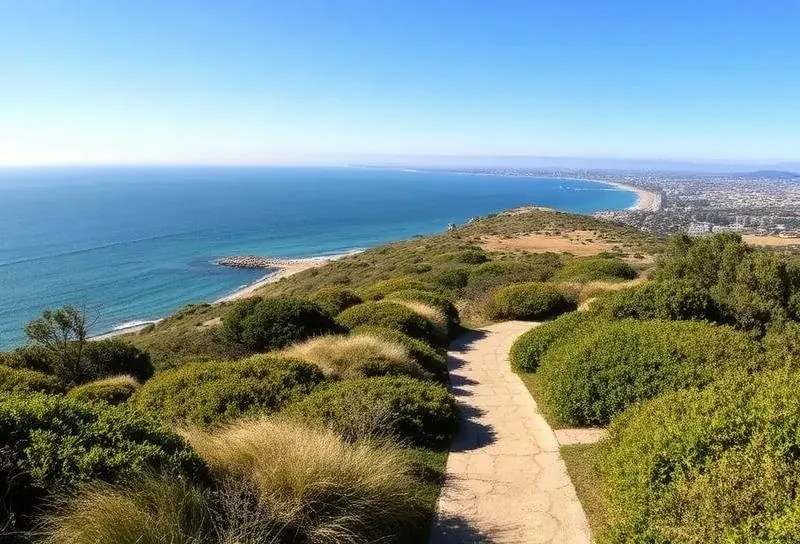
Coastal sage scrub trail with sweeping views of the Pacific, Coronado, and downtown San Diego.
Full Trail Guides
Every trail below has its own full guide — parking realities, trail conditions, what to bring, and the small insider details that make each hike memorable.
Quick Facts
- Distance: 3.3 mi out-and-back (or shorter)
- Elevation: Flat
- Time: 1–2 hrs
- Parking: Free lot at Gabbiano Lane
- Dogs: Leashed welcome
Carlsbad
Batiquitos Lagoon Trail
Batiquitos Lagoon is one of the few remaining tidal wetlands in Southern California, and its single flat trail along the north shore is the most relaxing nature walk in North County. Wedged between the back of Aviara golf course and the I-5 freeway, the lagoon is surprisingly quiet —…
Insider tip — Walk it within an hour of high tide for the best bird activity. The shorebirds concentrate on the exposed mudflats as the water recedes — perfect viewing from the elevated boardwalk sections.
Quick Facts
- Distance: 1.2 mi out-and-back
- Elevation: Flat
- Time: 30 min + beach
- Parking: Free lot at Cottonwood Creek Park
- Dogs: Leashed on trail, not on beach 9–6
Encinitas
Cottonwood Creek to Moonlight Beach
This is the easiest, most kid-friendly coastal walk in North County — a short, shaded trail that follows Cottonwood Creek from a quiet city park through a riparian corridor and ends, almost magically, at the sand of Moonlight Beach.…
Insider tip — On Wednesday and Saturday mornings the Encinitas Farmers Market is on at Paul Ecke Central School (just inland of Cottonwood Creek). Park there, do the market, then walk down the trail to the beach.
Quick Facts
- Distance: 1.8 mi loop
- Elevation: Flat
- Time: 1 hr
- Parking: Free lot at Nature Center
- Dogs: Leashed welcome
Solana Beach
San Elijo Lagoon Nature Center Loop
San Elijo Lagoon is one of the largest coastal wetlands in San Diego County — nearly 1,000 acres of restored salt marsh, freshwater pond, riparian, and coastal sage habitats — and the loop that starts at the Nature Center is the best way to sample all of them in under two miles.…
Insider tip — Come on a falling tide for the most active birding. The egrets and herons fish the exposed shallows, and the photography opportunities from the boardwalk are exceptional with the morning sun behind you.
Quick Facts
- Distance: 2.2 mi loop
- Elevation: 200 ft
- Time: 60–90 min
- Parking: Free street, residential
- Best time: Morning, before 10am
San Elijo Lagoon, Solana Beach
Annie's Canyon
Annie's Canyon is the most surprising hike in coastal San Diego — a narrow, sculpted slot canyon carved through soft sandstone, reachable in under a mile from a quiet neighborhood trailhead.…
Insider tip — Wear shoes you don't mind scuffing — the sandstone is soft and the slot will leave color on white sneakers. A long-sleeved layer prevents shoulder scrapes in the tightest sections.
Closed through February 2027
Quick Facts
- Distance: 1.3 mi loop
- Elevation: 300 ft
- Time: 60–90 min
- Parking: $15–25 in reserve, or free at bottom
- Dogs: Not allowed in reserve
Torrey Pines State Reserve
Torrey Pines Razor Point & Beach Trail Loop
This trail is closed with the entire Torrey Pines State Natural Reserve through February 2027. Full access is expected March 1, 2027; check California State Parks before visiting.
Closure — Do not enter the reserve or use its trails, road, Lodge, staircase, or upper lots. Torrey Pines State Beach and the North and South beach lots remain open.
Closed through February 2027
Quick Facts
- Distance: 0.7 mi loop
- Elevation: 50 ft
- Time: 30 min
- Parking: Small lot at trailhead, $15–25
- Best time: Late afternoon
Torrey Pines State Reserve
Torrey Pines Guy Fleming Trail
This trail is closed with the entire Torrey Pines State Natural Reserve through February 2027. Full access is expected March 1, 2027; check California State Parks before visiting.
Closure — Do not enter the reserve or use its trails, road, Lodge, staircase, or upper lots. Torrey Pines State Beach and the North and South beach lots remain open.
Quick Facts
- Distance: 0.6 mi out-and-back
- Elevation: 50 ft
- Time: 30 min
- Parking: Metered street near La Jolla Cove
- Best time: Sunset
La Jolla
Coast Walk Trail
The Coast Walk is barely a trail by mileage standards — just over a half mile each way along a bluff above La Jolla's famous sea caves — but it might have the highest views-per-step ratio of any path in San Diego.…
Insider tip — Walk it at low tide and look down — the waves crash into the sea caves below and you can hear them booming through the sandstone. Pair with a kayak tour of the caves for the same scenery from sea level.
Quick Facts
- Distance: 2.5 mi out-and-back
- Elevation: 100 ft
- Time: 1 hr + sunset
- Parking: Free street, easier weekdays
- Best time: Hour before sunset
Point Loma
Sunset Cliffs Coastal Trail
The Sunset Cliffs Coastal Trail isn't one official path but rather a network of dirt tracks that run for about 1.5 miles along the top of the bluffs in the southern half of Sunset Cliffs Natural Park.…
Insider tip — Look for the natural sandstone arch about 10 minutes north of the Ladera Street trailhead. It's just below the bluff edge — best photographed from the trail above, but viewable up close at very low tide via a steep informal path down.
Quick Facts
- Distance: 2.0 mi out-and-back
- Elevation: 300 ft
- Time: 1–1.5 hrs
- Parking: $20 entry, free with NP pass
- Water: At visitor center only
Cabrillo National Monument
Bayside Trail
The Bayside Trail is the only real hiking trail inside Cabrillo National Monument, and it might be the most scenic two miles of walking in the entire city of San Diego. From the historic 1855 Old Point Loma Lighthouse at the top of the peninsula, the trail descends gradually along the eastern flank of Point Loma —…
Insider tip — Visit on a clear winter morning between December and April. From the trail you can often spot migrating gray whales spouting offshore — Cabrillo is one of the best land-based whale-watching spots in California.
Best for
Find your perfect match
Best for first-time visitors
Top pick: Razor Point & Beach Trail Loop1.3 mi loop through twisted Torrey pines with the most photographed cliff views in California.
Best for sunsets
Top pick: Coast Walk TrailShort bluff path above La Jolla's sea caves — turquoise water, twisted pines, and unbeatable golden-hour color.
Best with a kid in tow
Top pick: Cottonwood Creek to Moonlight BeachEasy, shaded creek walk that ends magically at a family-friendly main beach.
Best for tide pools combined
Top pick: La Jolla ShoresDrop down to the sand at low tide for tide pools, then climb back via the beach trail.
Best for a slot-canyon surprise
Top pick: Annie's CanyonNarrow, sculpted sandstone slot you squeeze through sideways — feels like southern Utah.
Best for solitude and birds
Top pick: San Elijo Lagoon LoopBoardwalks, salt marsh, and 300+ recorded bird species — quiet even on weekends.
Know before you go
Plan it like a local
Start early in summer
Coastal trails are pleasant year-round, but inland trails (Cowles, Iron Mountain, Mission Trails) bake by 10am from June to September. Sunrise starts are sometimes the only comfortable option.
Carry water — not coffee
Bring at least 1 liter per person for any trail over a mile. There are no fountains on most San Diego trails. Hydration packs are worth it for longer walks.
Stay on the trail
Coastal bluffs collapse without warning — the cliff edge is undercut by waves below. Stay 10+ feet back from any unfenced bluff edge. Photo opportunities are not worth the fall.
Watch for snakes
Rattlesnakes are common in spring and summer. Stay on marked trails, don't reach into rocks or bushes, and keep dogs leashed. Bites are rare but expensive.
Wear real shoes
Sandals work on paved coastal walks but not on dirt trails. A trail runner or light hiker prevents twisted ankles on rocky descents.
Pack a windbreaker
The marine layer and onshore breeze can drop the perceived temperature by 10°F on a bluff. A light shell saves a chilly summit.
FAQ
Frequently asked
- What is the most popular hike in San Diego?
- Torrey Pines State Natural Reserve is the iconic coastal hike — a network of moderate trails through the only remaining wild Torrey pine forest in the world, with cliffs over the Pacific. The Razor Point and Beach Trail loop is about 1.5 miles round trip and one of the most photographed walks in California.
- What is the best time of year to hike in San Diego?
- October through May. Cooler temperatures, occasional wildflowers in February–March after winter rains, and clearer ocean visibility. Summer hikes are still doable but start at sunrise — by 11am inland trails can hit 90°F+ with little shade.
- Are there easy trails for kids and beginners?
- Yes. The Coast Walk Trail in La Jolla (mostly flat, ocean views), the Beach Trail at Torrey Pines (short, paved sections), and the boardwalk at Cabrillo National Monument are all suitable for young children and casual walkers.
- Do I need a permit to hike in San Diego?
- Most trails are free. Torrey Pines State Reserve and Cabrillo National Monument charge a parking fee ($15–25/vehicle, or use an annual pass). Cuyamaca and Anza-Borrego state parks have day-use fees. Trail itself is always free; the parking lot is what costs.
- Are there any rattlesnakes on the trails?
- Yes — Western rattlesnakes are common in coastal sage scrub year-round, more active March through October. Stay on marked trails, don't reach into rocks or bushes, and watch where you step. Bites are rare with awareness. Keep dogs on leash.
- Where can I find wildflowers?
- After a wet winter, the Anza-Borrego desert (1.5 hrs east) blooms spectacularly in late February and March. Closer in, Mission Trails Regional Park, Torrey Pines Reserve, and the Bayside Trail at Cabrillo all show good native wildflower displays in spring.