Local Dispatch
Notes from the Bluffs: What the Del Mar Cliffs Are Doing Right Now
· 7 min read
A Del Mar local reports on recent bluff break-offs along the coast, what Scripps tiltmeters are recording, and how to read the sandstone before your next beach walk.
From the bluff-top path
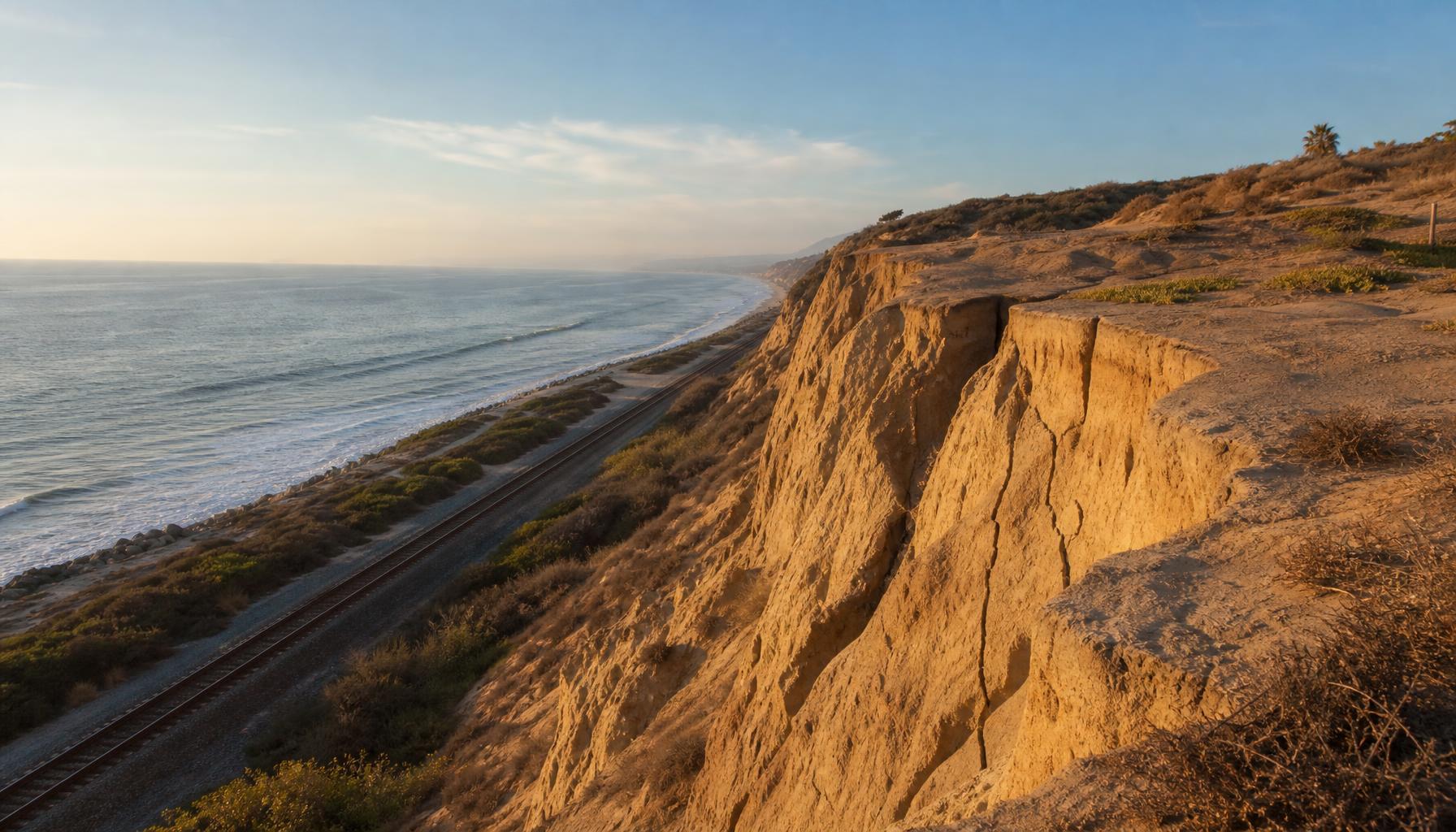
I walk the Del Mar bluffs most mornings. In the last month, the trail has started feeling different underfoot. New cracks have opened in the sandstone above 15th Street, a fresh scarp has appeared south of Powerhouse Park, and twice I have heard the low, sandy thud of a section letting go after a high tide.
No one was hurt in either case. Both breaks were small — maybe a few cubic yards each — but they were close enough to the rail corridor and the beach access stairs that they got my attention. They should get yours too.
What I am actually seeing
Here is what I can confirm from my own walks:
- South of Powerhouse Park: a new vertical scarp roughly 6–8 inches high, running parallel to the edge, with fresh tan sand at the base.
- Near 15th Street: a widening crack in the paved overlook, now marked with temporary city tape.
- After high tides: small amounts of debris — sandstone chunks, iceplant, loose soil — on the beach access stairs below the bluff.
I am not a geologist. These are observations, not measurements. But they match what the California Coastal Commission and Scripps researchers have been saying for years: this stretch of coast is eroding faster than the historical average, and the pace is not even along the bluff.
What the instruments say
The Scripps Institution of Oceanography maintains tiltmeters and GPS stations along the Del Mar bluffs. Their public summary is straightforward: the bluffs move in response to a combination of wave attack at the toe, groundwater saturation after rain, and long-term sea-level rise that shifts the baseline higher every decade.
The most useful number I have found is this: in wet winters, saturated sandstone can lose cohesion fast. A bluff that looks stable in October can shed material after a single winter storm. That is why the recent high tides — even without major surf — produced visible changes.
Why this matters for a beach day
Most visitors do not need to cancel a trip to Powerhouse Park. The beach itself is wide and open, and the active erosion is happening at the top of the bluff, not the sand below. But a few habits are worth adjusting:
- Stay off the bluff-edge trails that are taped or fenced. Fresh scarps are unstable by definition.
- Do not sit directly below the cliff line at high tide. Even small falls can injure someone.
- Keep dogs and kids back from the base of the bluff. Rocks and iceplant can fall without warning.
- Report new cracks to the City of Del Mar or the lifeguard tower. They track this data.
What to watch for next
The next significant erosion windows are usually:
- After the first heavy winter rain, when groundwater pressure builds in the sandstone.
- During king tides, when high water reaches the toe of the bluff more often.
- After large northwest swells, which undercut the base and remove the beach buffer.
If you see any of the following, move away and report it: a new crack wider than your thumb, a fresh overhang, water seeping from the bluff face, or a recent fall of material at the base.
The bigger picture
Del Mar is not falling into the sea. But it is changing visibly, and the changes are happening on a human timescale now. The bluffs I walked as a teenager are narrower than they were then. The stairs at Fletcher Cove have been rerouted. The rail corridor is being moved inland in places because the current alignment is no longer stable long-term.
This series — Notes from the Bluffs — is my attempt to document what that looks like from the ground, one walk at a time. If you have seen something along the coast that should be in here, send it through our contact page.
Related reads
- Powerhouse Park beach guide
- San Diego tide charts and station selector
- King tides and coastal flooding guide
Last updated from the bluff-top path on August 1, 2026.
Frequently asked
- Is Del Mar beach safe to visit right now?
- Yes. The beach itself remains open and safe for normal use. Erosion is concentrated at the top of the bluffs. Stay back from the cliff base and respect any taped-off bluff-top trails.
- What causes Del Mar bluffs to collapse?
- Wave attack at the toe, groundwater saturation after rain, and long-term sea-level rise all weaken the sandstone. The combination is what produces sudden break-offs.
- Where can I report a new crack or bluff fall?
- Contact the City of Del Mar public works department or the nearest lifeguard tower. They track erosion reports and use them to prioritize inspections.